
Terrain Under the Forest — Drone LiDAR Survey in Full Leaf
We surveyed 15.9 ha of forest, park and open land with a LiDAR drone while the trees were still in leaf. The laser reached the ground even under the densest crowns — here are the profiles, the terrain model with contours and how we describe the tree cover.
Airborne laser scanning (LiDAR) from a drone measures the relief even where only tree crowns are visible from the air. The laser sends hundreds of thousands of pulses per second and some of them pass through the gaps between the leaves and reach the ground. So from a single flight we get both the terrain model under the forest and the height of every tree. This example is deliberately at the hardest time — September, in full leaf.
In short
- Area: 15.9 ha — a dense broadleaf strip, a park with individual trees, buildings and open meadows.
- Equipment: RIEGL miniVUX-3UAV LiDAR sensor on a DJI Matrice 400 drone, plus a camera for the orthophoto.
- Flight: 13 strips, about 14 minutes of scanning.
- Point cloud: 39.2 million points — on average 247 points per m².
- Terrain under the canopy: under trees taller than 5 m the laser reached the ground with 34 points per m² on average.
- Georeferencing: 9 ground control points; residuals after adjustment range from millimetres to about 5 cm.
- Results: terrain model (DTM) with 1 m contours, profiles, a canopy height model and 800 automatically detected trees taller than 5 m.
The site
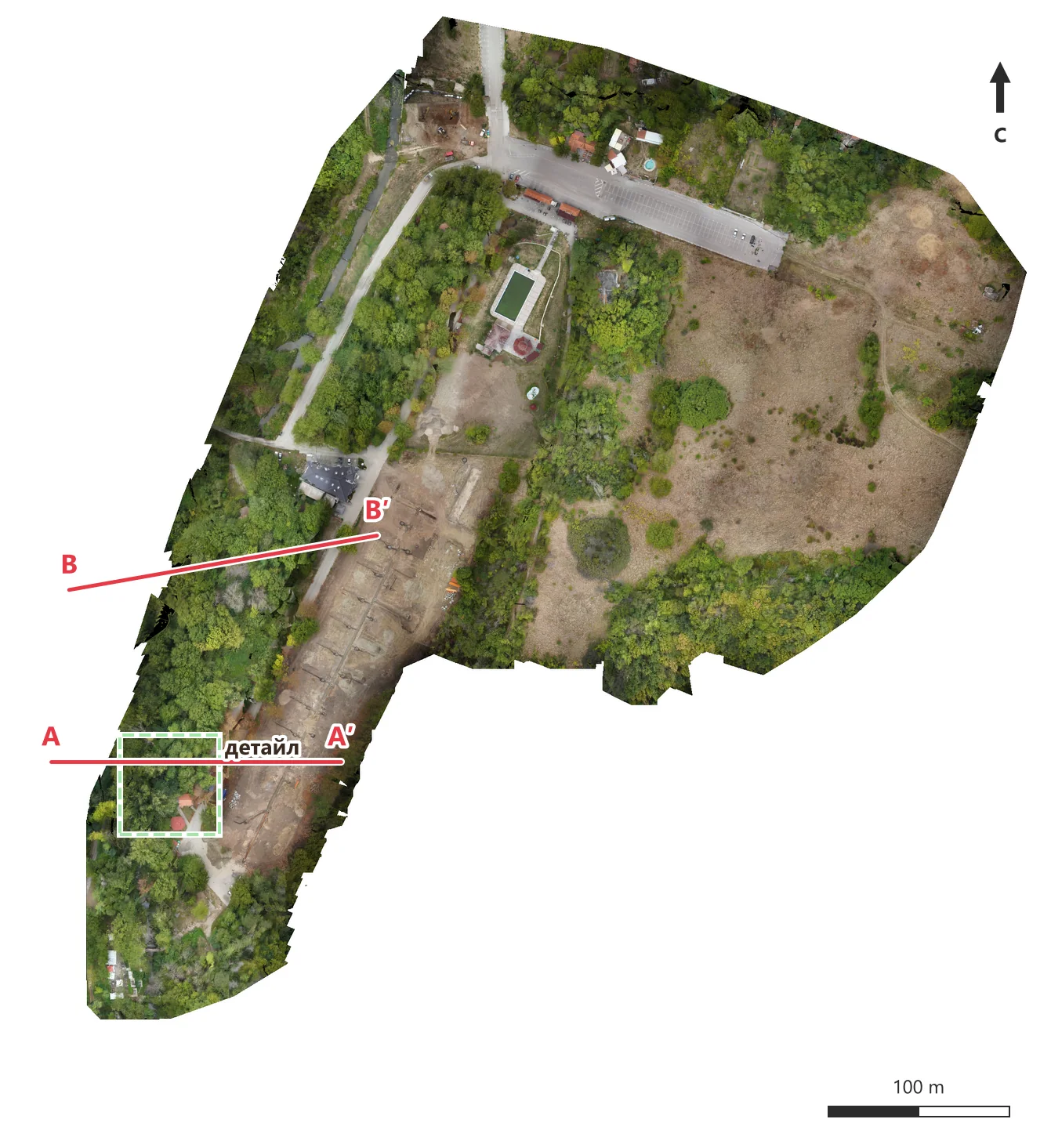
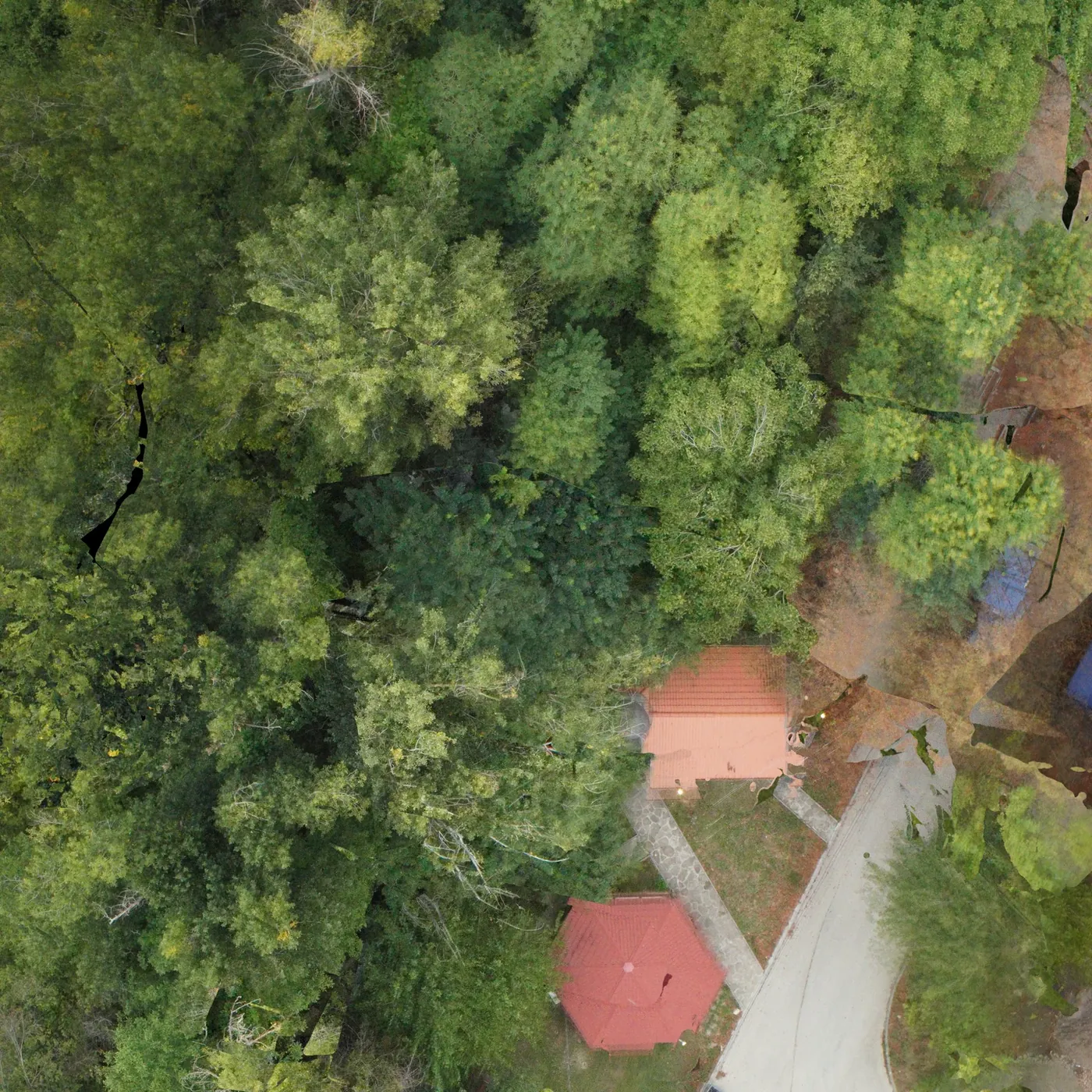
The site is in Northern Bulgaria. Names and coordinates are not shown. The orthophoto, at about 1.6 cm per pixel, shows how dense the crowns are in the western part — the ground is practically invisible.
Profiles through the forest
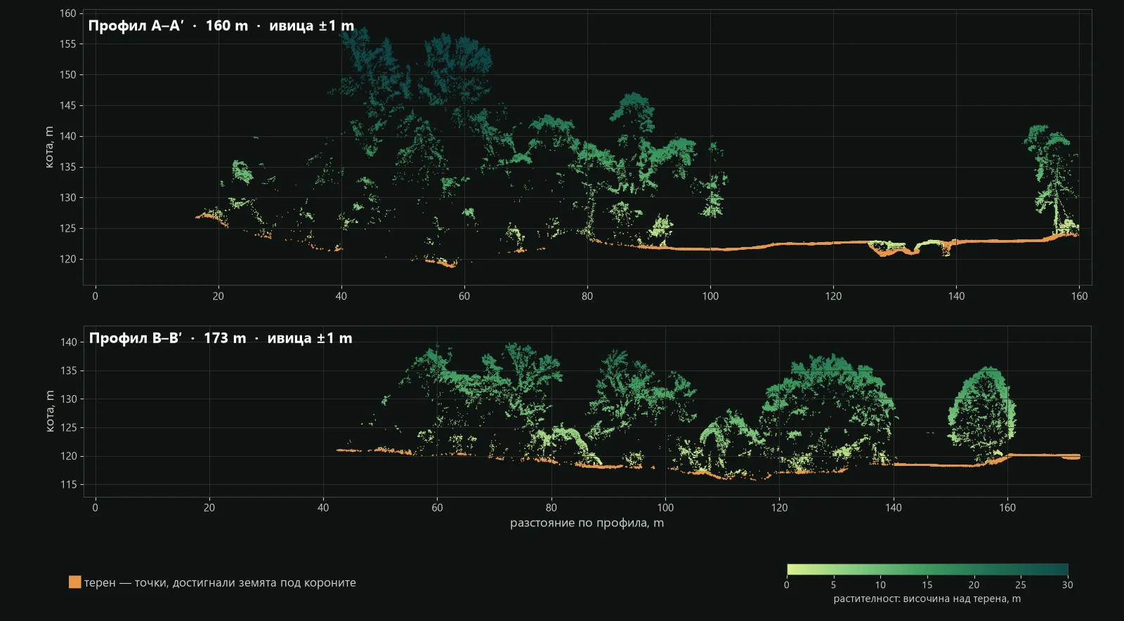
A profile is a narrow strip of the cloud (here ±1 m) viewed from the side. Points that reached the ground are orange; vegetation is coloured by height above ground. The terrain under the canopy is continuous: the slope, the ditch at 130 m in profile A–A′ and the small irregularities under the trees are all visible.
With and without the trees
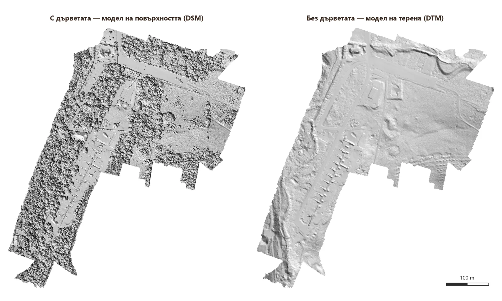
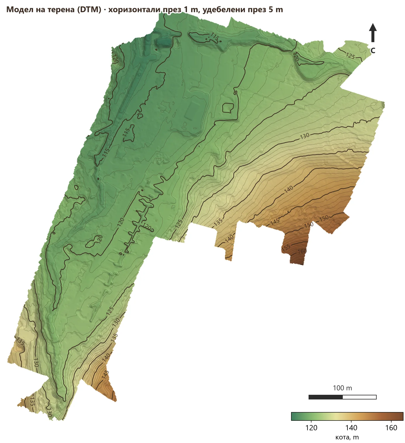
The digital surface model (DSM) shows what the camera sees — the crowns. The digital terrain model (DTM) is the same place with the trees “removed”. Under the forest appear terraces, embankments, ditches and old roads that are not visible on the orthophoto at all.
Terrain model with contours
From the ground points we build a digital terrain model (DTM) and from it contours, profiles and volumes. The map below is in GIS style: colour by elevation, hillshading and contours at 1 m.
How we describe the tree cover
The difference between the surface and the terrain gives the canopy height model. From it we describe the vegetation with numbers rather than “dense forest”:
- Cover: vegetation over 2 m covers 50% of the area, trees over 5 m — 40%.
- Tree count: 800 trees over 5 m, detected automatically from the crown tops.
- Heights: median 12.5 m, 168 trees over 20 m, the tallest about 38 m.
| Height class | What it is | Share of area |
|---|---|---|
| 0.3–2 m | grass and low shrubs | 10% |
| 2–5 m | shrubs and undergrowth | 9% |
| 5–10 m | low trees | 15% |
| 10–20 m | trees | 20% |
| over 20 m | tall trees | 5% |
| — | buildings and structures | 1% |
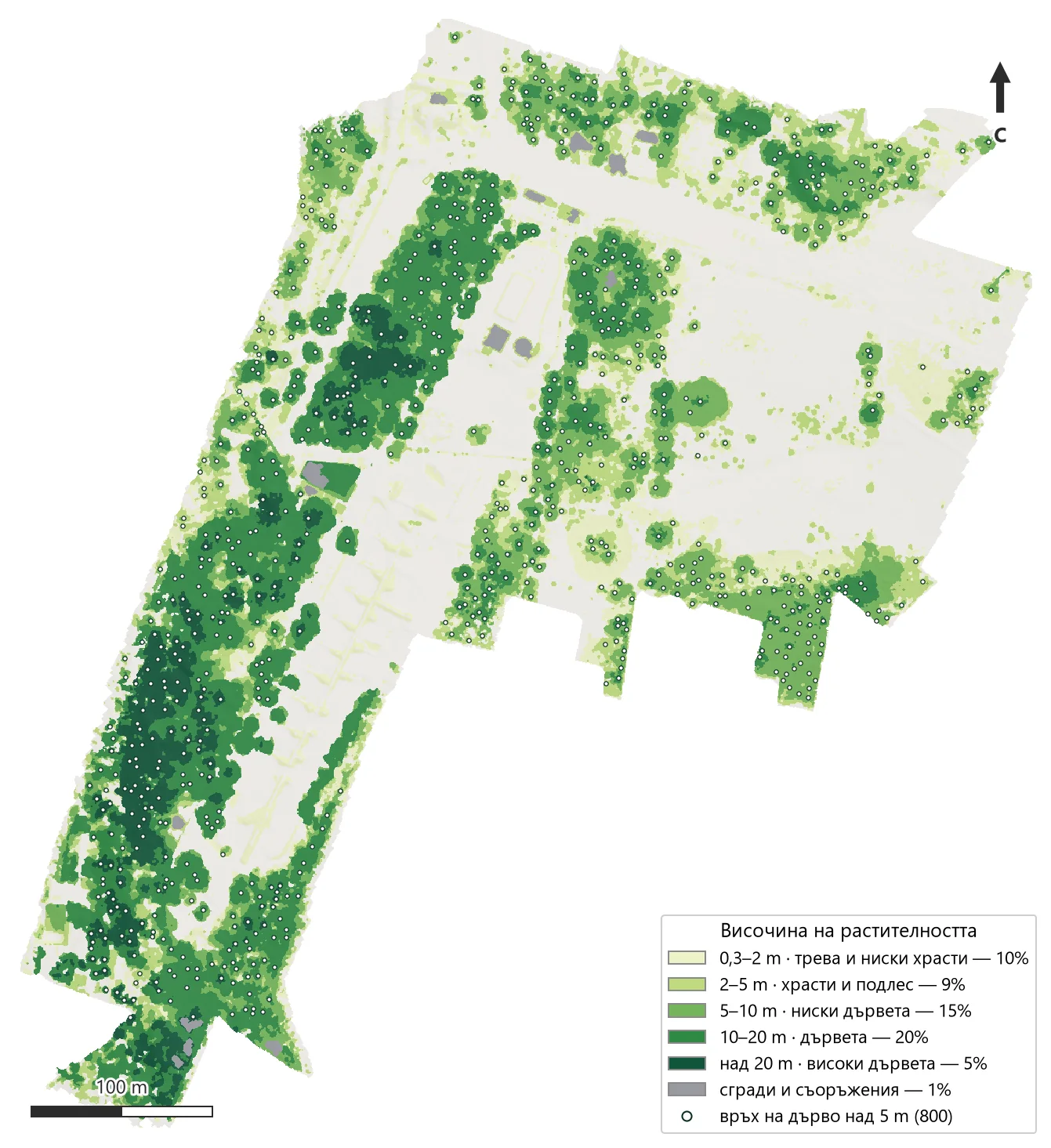
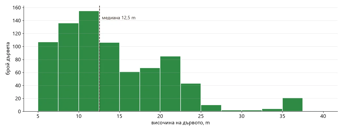
The tree count is an automatic estimate: where crowns grow together, two trees are sometimes counted as one. When higher accuracy is needed, we check selected areas in the field.
Why LiDAR and not a regular drone survey
A regular drone survey (photogrammetry) builds the model from photos and sees only what is visible from above — here, the crowns. LiDAR records several returns from each pulse and therefore captures both the crowns and the ground beneath them. Flying leaf-off is best, but this site shows that the terrain is captured reliably even in full leaf.
How we work
- Planning. Route, altitude and strip overlap; placement of ground control points.
- Flight. The drone scans the planned strips autonomously; the camera takes photos for the orthophoto.
- Trajectory and adjustment. We compute the trajectory (GNSS/IMU) and adjust the strips to each other and to the control points.
- Classification. We separate ground points from vegetation and buildings.
- Products. DTM, DSM, contours, profiles, canopy height model and report.
What you receive
| Result | Format |
|---|---|
| Classified point cloud | LAS / LAZ |
| Terrain model (DTM) and surface model (DSM) | GeoTIFF |
| Contours and profiles | DWG / DXF / SHP, PDF |
| Orthophoto | GeoTIFF / ECW |
| Canopy height model and tree tops (on request) | GeoTIFF, SHP / CSV |
| Report with methodology and accuracy |
Frequently asked questions
Can LiDAR capture the terrain through dense forest?
Yes, if there are gaps between the leaves — and there almost always are. In this example, under trees taller than 5 m the laser reached the ground with 34 points per m² on average, which is enough for a terrain model and 1 m contours.
When is the best time to fly?
Leaf-off is best — late autumn, winter and early spring. When the project cannot wait, we fly in leaf, as here.
What is this data used for?
Design of roads and routes through forest, vegetation encroachment on power lines, forestry, cadastre and subdivision of forest properties, quarry and stockpile volumes, finding old roads and terraces under vegetation.
Have a site under forest?
Send us the site boundary (KML, DWG or a sketch) and what you need — terrain, contours or tree data. We will propose a flight and a timeline. Send an inquiry or see the Drone LiDAR surveying service.
The project at a glance, with photos: Terrain Under Forest — Drone LiDAR Survey. More completed work — in Projects.
Author: GM Engineering